
Maps & Brochures
For the best advice and directions we welcome you to visit us at the Lake Grace Visitor Centre. We have a selection of local town maps and trails, free camping information, wildflower information and local knowledge.

Kwongan Heathland Walk Lake Grace
A new trail 5km east of Lake Grace to discover.
Bushland with a well marked trail and interpretive signs of it’s fascinating flora. A well loved wildflower hotspot.
For more information call into the Visitor Centre.

Shire of Lake Grace Brochure.
The Shire of Lake Grace is comprised of the five townships of Lake Grace, Newdegate, Lake King, Varley and Pingaring.
In this brochure find out what there is to see and do in each town plus there is a comprehensive contact list of accommodation, meals, fuel/mechanical, tourist information, rest areas, internet access spots and medical information.
Produced by the Shire of Lake Grace

Lake Grace Salt Lake.
Lake Grace is a large, shallow salt lake situated 10km west of the Lake Grace townsite. It is comprised of two separate water bodies – Lake Grace North and Lake Grace South.
As one of WA’s largest inland salt lakes, measuring 23km long, it is well worth a visit to the Lake Grace lookouts.
For more information on how the salt lakes were formed please download the brochure.
Produced by the Shire of Lake Grace

Australian Inland Mission Hospital Museum Brochure.
The Lake Grace Australian Inland Mission Hospital Museum (AIM) is the only hospital to be converted to a museum in Western Australia.
For more information about the museum, opening times and guided tours please contact the Lake Grace Visitor Centre or click on the link below to download the brochure.
Produced by the Shire of Lake Grace
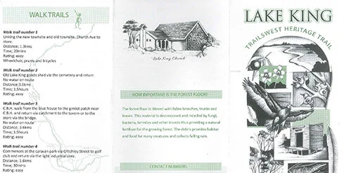
Lake King Trailswest Heritage Trails.
The Lake King Walk Trails have been provided for the enjoyment of locals and visitors who wish to undertake short walks and enjoy local wildflowers, native vegetation and a little history.
The brochure includes contact numbers, a may, key of local flora and fauna and description of four different walk trails.
Produced by The Lake King Progress Association.

Holland track.
Welcome to the John Holland Way and The Holland Track.
Follow in the steps of one of Western Australia’s early pioneer explorers and discover the riches of Western Australia’s Golden Outback Region
Produced in collaboration with the Shire of Broomehill, Kojonup Visitor Centre, Katanning Tourist Information Centre, Lake Grace Visitor Centre, Hyden Visitor Centre, Coolgardie Visitor Centre, Kambalda Community Resource Centre, Kalgoorlie-Boulder Pure Gold, Norseman Visitor Centre, Western Australian Visitor Centre.

Pathways to Wave Rock.
Roe Tourism Association is a collaborative non-for-profit partnership between the Shires of Bruce Rock, Corrigin, Kondinin, Kulin, Lake Grace, Narembeen and Quairading. Roe Tourism Association works together with the community and local business to promote the ‘Pathways to Wave Rock’ Self-Drive Trail and the many extraordinary experiences which the region has to offer.
Produced by Roe Tourism Association

Ocean to Outback 2009.
Ocean to Outback is a Lakes Self Drive Experience Route 107
If there is one common theme along Route 107 that links the tall timbers of the Indian Ocean hinterland to the endless horizons of the outback, it is the numerous lakes and waterways that lie along its entire 390 kms. Enjoy the experience… and please drive safely.
Produced in collaboration with the Shire of Collie, Shire of West Arthur, Shire of Wagin, Shire of Dumbleyung and Shire of Lake Grace.